A good July 4 for us, not so much for our East Coast friends
- June 30, 2014
- / Ron Stallcup
- / community-dashboard
The weather for Northwest Florida looks good through the July 4 weekend. High temperatures in the low 90s and 20 percent chance of rain are on tap for the next few days.
It doesn’t look good for residents of the east coasts of Florida, Georgia and the Carolinas.
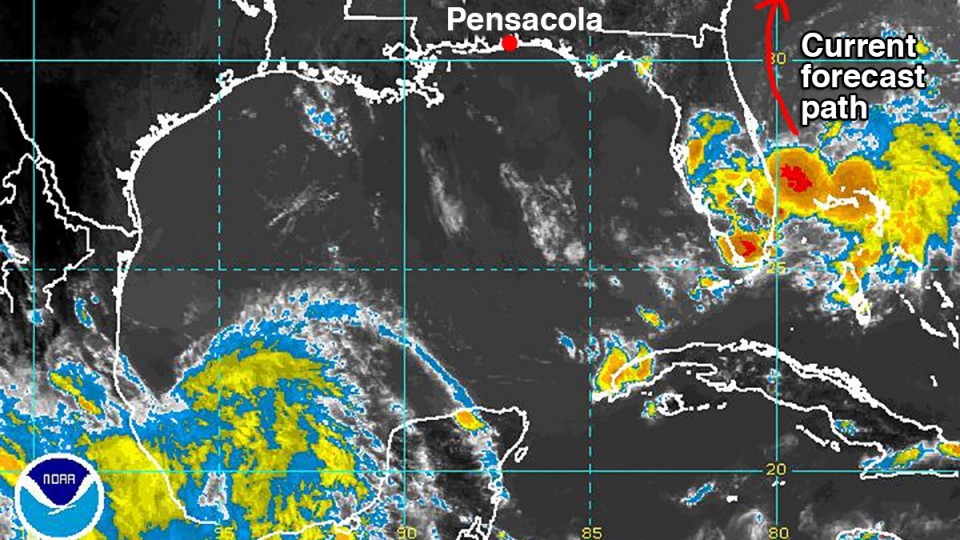
All eyes are on a storm brewing in the Atlantic off the east coast of Florida.
At 4:30 p.m. Monday, the area of low pressure has an 80 percent chance to develop into the first named storm, “Arthur,” of the 2014 hurricane season. Hurricane hunter aircraft are flying reconnaissance into the low pressure off West Palm Beach.
All relevant hurricane forecasting computer models are showing a consistent track moving north that hugs the coastlines of Florida, Georgia and the Carolinas through the July 4 weekend.
Computer models that forecast how strong this storm may get, are showing a strong tropical storm or a weak Category 1 hurricane gaining strength around Thursday or Friday. Rough waters for boaters and beach erosion are expected for the east coast of the U.S. during the next few days.
It’s highly unlikely we will be impacted by this storm, but don’t let your guard down as we get deeper into the hurricane season.
This is a perfect time to stock up on batteries, and learn if you are in an evacuation zone, or where the closest shelter is to your home.
MUST HAVE BOOKMARKS
ESCAMBIA COUNTY: www.myescambia.com/beready
SANTA ROSA COUNTY: www.santarosa.fl.gov/hurricanecenter
[progresspromise]
Recent Posts
-
 CivicCon launches with a look at good growth in cities
-
 Building stronger brains one baby, one parent at a time
-
 SCI debuts commercial on Early Learning City
-
 Entrecon: World class speakers and an opportunity to sharpen skills
-
 PYP Quality of Life survey 2017
-
 EntreCon Pensacola 2016: A look back
-
 Leadership tip: getting better employee takeaways
-
 Leadership tip: be interested instead of interesting
-
 Leadership tip: delivering difficult messages
-
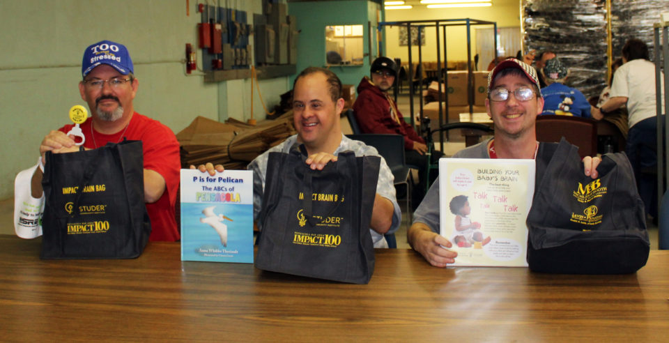 Brain Bags boost Arc, Early Childhood Court programs